Which Part of a Beach Can You Actually Leave Something On — and For How Long?
Backshore, berm, beach face, swash, hard-pack, wrack line: which part of a beach you can leave gear on, how long each spot lasts, and how to read it.
You come back from the water and something has moved. Maybe it's only the umbrella shade, which has slid off the towels and onto the cooler. Maybe the edge of the blanket has gone dark. Maybe it's the shovel, floating.
A beach is the only place most of us spend an entire day where the ground itself is on a schedule. A picnic table is where you left it eight hours later. A driveway is where you left it. On a beach, a good share of the ground you can see from your chair will be somewhere else by dinner, and the part that won't move is loose enough that nothing stands on it without an argument.
So the question people actually ask when they get to the top of the ramp with a cooler in each hand isn't a physics question. It's a real-estate question with a lease attached: which part of this can I put my stuff down on, and how long is that good for?
Here's the whole answer in one paragraph, and then the reasoning, because the reasoning is what lets you make the call on a beach you've never been to.
The short version. The only ground on a beach you can leave something on for a whole day is the dry sand landward of the freshest wrack line. Everything seaward of that line is rented by the hour, and the most inviting sand on the beach — the firm hard-pack near the water that your chair doesn't sink into — is firm because water was on it recently and will be again. And getting above the wrack line doesn't buy you a surface with no rules. It just moves you from the tide clock onto the sun clock and the wind clock, which run on their own schedules and take out different things.
There is no zone on a beach with no clock running. Picking a spot is choosing which clock you'd rather be on.
Before you drop the bag, look down the slope. A beach publishes its own recent history in four visible lines, and reading them takes about fifteen seconds once you know what you're looking at.
1. The wrack line — the receipt. That ragged band of dried seagrass, shell hash, feathers, bladderwrack and the occasional bottle cap isn't litter. It's the exact elevation where the last high tide stopped and dropped what it was carrying. It is the single most useful line on the beach, and it costs nothing to read.
The part most people miss: there is usually more than one. The freshest is lowest, still damp, and smells like it. Above it, drier and more bleached and often chunkier, sits an older one — the last set of spring tides, or the last storm. Those two lines together tell you two different things: where the water got last night, and where the water gets when the month is going badly. If you're setting up for a whole day, especially near a full or new moon, the top line is the one to respect.
2. The berm crest — the step. A berm is "a nearly horizontal shore parallel ridge formed on the beach due to the landward transport of the coarsest fraction of the beach material by the wave uprush." That's the technical way of saying: the water piles up the heaviest sand at the very end of its own reach and builds a low ridge there. Walk down toward the water and you'll feel it as a small step down — a place where the slope changes character under your feet. Above the step, the beach has been mostly left alone. Below it, the beach is actively being worked.
Two honest caveats. Beaches may have several berms, or none at all. And a berm records the wave climate that built it — a crest formed over a calm fortnight is a promise made in easy conditions, and the first real swell will overrun it.
3. The damp line — today, in progress. The color change from dark sand to pale sand is where the water has reached during this tide, and unlike the wrack line it's still moving while you look at it. If the damp line is already above the fresh wrack, the water is doing better today than it did last night — worth knowing before you pick a spot.
4. Footprints. Cheapest instrument on the beach. Press a heel in. Where the print slumps and crumbles at the edges, you're on dry backshore sand. Where it holds a crisp edge, and especially where water seeps into the bottom of it, you are standing on sand that was underwater recently enough to still be saturated.
One gotcha. If the sand is combed into neat parallel lines, a groomer came through at dawn and the wrack line you'd have read is in the back of a truck. Municipal and resort beaches do this all season. When the beach has been raked, you've lost your best signal — fall back to the berm and the damp line and give yourself more room than feels necessary.
Walking up from the water.
The swash zone is the strip where the wave bores run up and down the beach face — uprush, then backwash, then again. It is by definition never the same ground twice, and nothing gets set down here. Not for a second, not "just while I get the chair open."
The cruel part is that this is the firmest, flattest, most walkable sand on the entire beach, which is exactly why people keep putting things on it. Firmness is a receipt for recent water, not a permit for future dryness.
What the swash zone is genuinely good for: rinsing sand off a foot, cooling a hand, and letting a kid stand in it.
The beach face is "the zone between the mean low water (MLW) and the seaward beach berm," and it's regularly wetted by tides and swash under ordinary conditions. In other words, the entire strip between the water and the berm is designed by nature to get wet on a normal day. Not a storm day. A normal one.
This ground is excellent for anything you are actively supervising: the digging operation, the chair you're sitting in, a low-tide game of paddleball, the morning walk with a coffee. It is a bad place to leave anything, and it's also sloped by definition, so anything you set down there starts out on a tilt.
Its expiry is not "a few hours." Its expiry is whenever the tide turns, and then the arithmetic in the next section takes over.
On a falling tide this band is the sweet spot: firm enough to set a chair on, and getting safer by the minute. On a rising tide it is the worst real estate on the beach, because it looks completely fine right up until it isn't. Same sand, opposite answer, and the only thing that separates them is a fact you can look up in ten seconds before you leave the house.
Above the step, on a normal day, you are off the tide clock. This is where the cooler goes. This is where the bag with the car keys in it goes.
Two reasons. It's the precise elevation the water reached, so it's the first thing to get wet if anything does. And it is a working ecosystem — sand fleas and kelp flies live in it, and they are not interested in your towel's boundaries.
The backshore is "the part of the beach lying between the beach face and the front dune, cliff base, vegetation line or coastal protection structure." It stays dry under typical conditions, and sees wave action only during extreme events with high tide and storm surge.
That's the answer to the headline question. The backshore is the ground you can leave something on for a whole beach day. And the second you get there, the other two clocks start running.
Don't. They're fragile, they're usually protected by law, and the sand back there is the softest on the beach anyway.
If you take one section from this page, take this one, because these numbers turn a vague worry into a decision.
The cycle. A lunar day — the time for a spot on Earth to rotate from directly under the moon back to directly under it — is 24 hours and 50 minutes. On a semidiurnal coast, high tides come 12 hours and 25 minutes apart, and it takes about 6 hours and 12.5 minutes to go from high to low.
The tide does not move at a steady rate, and this is where people get caught. The old mariner's approximation, the rule of twelfths, splits that six-hour swing as 1/12, 2/12, 3/12, 3/12, 2/12, 1/12 — the ratio 1:2:3:3:2:1. Half of the entire vertical change happens in the middle two hours. It's a rough approximation and it only holds where the tide curve is roughly a sine wave, so don't navigate by it. But directionally it's the thing to know: the tide loafs, then it moves. "It hasn't come up at all in the last hour" tells you almost nothing about the next hour.
Turning vertical feet into horizontal feet. This is the step nobody does, and it's why no one can honestly tell you "sit thirty feet back." A tide table gives you a height. What you care about is a distance. To convert, you divide by the slope — and slopes vary enormously. Coastal Wiki gives the average slope of the upper shoreface — the nearshore zone the beach face grades down into — as somewhere between 1/10 and 1/100, and notes that coarse-grained beaches typically have steeper slopes than fine-grained ones. Take that spread as an order of magnitude rather than a measurement of the sand in front of you: on a slope of 1/10, one vertical foot of tide moves the waterline about ten feet; on 1/100, about a hundred.
On a broad, fine-sand, shallow-sloped beach, a foot of tide can eat a bus length of dry sand. On a steep, coarse-sand pocket beach, the same foot barely moves the line. This is precisely why reading the wrack line beats doing arithmetic: the wrack line has already done the conversion for you, on this beach, with this sand, under last night's actual conditions.
Your coast changes the whole answer. NOAA publishes tidal datums for its stations, and the spread is bigger than most people assume:
| Station | Mean range of tide | Great diurnal range |
|---|---|---|
| Atlantic City, NJ | 4.02 ft | 4.60 ft |
| Santa Monica, CA | 3.76 ft | 5.43 ft |
| Naples, FL | 2.01 ft | 2.87 ft |
Look at the second column. Santa Monica's biggest daily swing is larger than Atlantic City's — but it arrives differently. The U.S. West Coast tends to run mixed semidiurnal, with two highs and two lows of different sizes each lunar day; the East Coast is more typically semidiurnal, with two of roughly equal size; and parts of the Gulf of Mexico run diurnal — one high and one low per lunar day.
Translated into beach-day terms: on the Gulf, you can more or less pick a spot and stop thinking about it. In Southern California, one of the day's two tides is the one that matters and the other is a rounding error, so it's worth knowing which is which. On the mid-Atlantic, you get two chances a day to be wrong.
The fortnight. Each lunar month brings two sets of spring tides and two sets of neaps. And 6–8 times a year, a new or full moon lines up closely with the moon's perigee — a perigean spring tide, when it is not uncommon for high tides to run more than a foot higher than they would at apogean springs — though how much higher is location dependent. A foot sounds like nothing until you divide it by the slope.
The single most useful fact for a regular. High tide runs about 50 minutes later each day. Seven days of that is about 5 hours and 50 minutes — very nearly half a cycle. Which means: your usual beach, your usual Saturday, your usual arrival time, next weekend, will be at close to the opposite state of the tide from today. Two weeks out, you're roughly back where you started. If you have a favorite spot that "always works," it works on a fortnightly rhythm, and one Saturday a month it quietly doesn't.
Two things the number leaves out, and either one can put the water higher than the table says.
First, from NOAA's own FAQ: "We can only predict the astronomical tides; water level changes created by the gravity of the Moon, and the relative motions of the Earth, Sun and Moon. We cannot predict the effect that wind, rain, freshwater runoff, and other short-term meteorological events will have on the tides." How far off that puts you depends on where you are, and it runs in both directions. NOAA's worked example is Baltimore, at the head of Chesapeake Bay, where winds blowing along the length of the bay "have been known to cause water levels to be 1-2 feet above or below the predicted tides." But NOAA offers Baltimore as a hard case, and says in the same passage that predictions for stations along the outer coast are generally more accurate than those for inland stations. So don't budget two feet of error on an ocean beach — do budget for the prediction being a number with weather sitting on top of it.
Second, and more relevant on an ordinary sunny day with a bit of swell: the tide table describes a still-water level, and the ocean at your feet is not still. Wave run-up — "the maximum vertical elevation reached by the uprush of waves on a beach" — sits on top of that predicted level. The slowly varying wave set-up component alone runs, as a rule of thumb, on the order of 20 percent of the offshore significant wave height, with the oscillating swash stacked on top of it, and run-up scales with both wave height and beach slope. On a day with real surf, the water reaches meaningfully farther up the beach than the prediction implies.
Which cashes out as one rule worth more than any table: the sets decide, not the average. Waves arrive in groups. The fact that nothing has come near your towel in two hours is not evidence about the next four minutes.
The stick trick. If you didn't check before you left: push a shell or a stick into the sand at the farthest point a wave reaches, and look again in fifteen minutes. Not five, not ten — wave groups will lie to you over a short window. Fifteen minutes gives you an answer you can trust.
The sun clock. Shade migrates. The umbrella you planted at ten o'clock is shading the cooler by one, and re-planting it moves everything under it — which means the "permanent" spot on the backshore is being quietly rearranged all day. Meanwhile the sand in full sun is running far hotter than the air, so the ground your drink is standing on is warming it from underneath the whole time.
The wind clock. The National Weather Service defines a sea breeze as "a thermally produced wind blowing during the day from a cool ocean surface onto the adjoining warm land, caused by the difference in the rates of heating of the surfaces of the ocean and of the land." Because it's driven by the land heating up, it builds through the day rather than showing up at random — which is why on clear summer days it feels like it arrives on a timetable, and why it is usually at its strongest in the afternoon rather than first thing in the morning.
Here's the trade nobody spells out. The backshore is the zone that solves the tide problem, and it is also the zone where cups blow over. Getting above the water puts you on the loosest sand and in the strongest breeze on the beach. That's still the right trade. It just isn't free.
Everything above is about the cooler, the bags and the umbrella — a decision you make once, at the top of the ramp. A drink is a decision you re-make forty times, one-handed, without looking.
Three things follow from the zone map:
1. The drink lives where you are, not where the flat surface is. If you're down at the waterline with the kids for an hour, a drink carried down there is on the tide's clock, and the cooler lid two hundred feet up the beach is a shelf you have to keep walking to. Decide which, honestly, before the first one is opened.
2. On the backshore, everything is loose sand or fabric laid over loose sand. A can pressed into dry sand stands in a socket that keeps re-shaping as the grains settle unevenly beneath it, so it leans a little more each time anyone walks past, and a small bump finishes the job. A towel doesn't fix that — it just passes along whatever the sand underneath it is doing. And the one genuinely rigid surface in reach, the cooler lid, is also a door that gets opened every ten minutes.
3. The fix has to be about the base. A koozie changes the temperature and not the footing. A stake changes where the drink is but depends entirely on how well it's planted in sand that shifts by nature. What actually changes the odds is standing the container on a base wider than its own.
The thing we make, and what it won't do
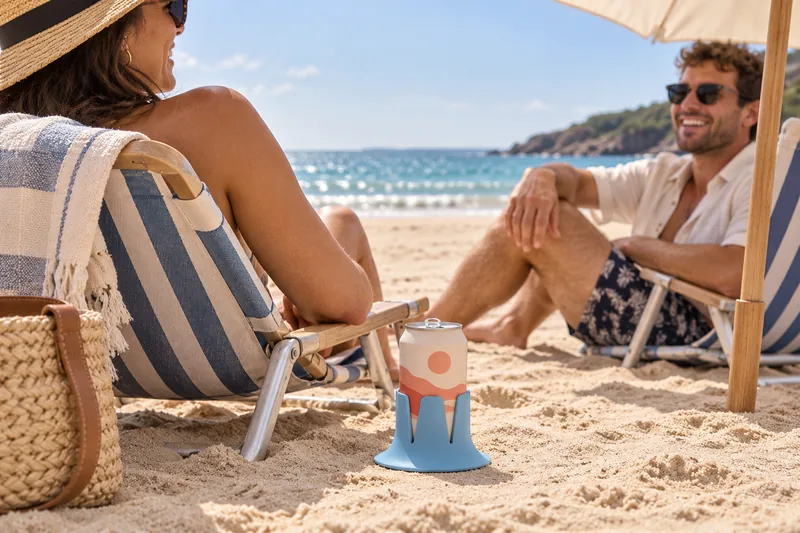
Since you're on a page about honest limits: Steadi is one piece of Shore 85A TPU — not silicone — about 2.8 inches tall, with a base 5.2 inches across that stays 5.2 inches across. It doesn't expand, contract or deform. The fins flex to grip the bottom inch of a can or a bottle, and the whole thing settles in when you set it down. Whether a particular tumbler or travel cup seats comes down to the diameter of its base, so measure yours against the current fit information at steadilabs.com rather than taking a number from us here.
What it does is one thing. It widens the base of support underneath the container, so the drink's center of mass has to travel much farther sideways before it passes outside that base — which means tipping now takes a far larger tilt than it did. On a cooler lid, the tack of the TPU also resists sliding when the breeze fills in. It's dishwasher safe and molded in Orange, California. Patent pending.
The limits, plainly. It does not float — it sinks. It belongs up on the backshore, not out past the swash line, and if it goes into the water on a falling tide, you're going after it. It is not a mount, a clamp, a strap or a restraint, and a direct hard knock — a kid at a dead run, a dog changing direction — still wins. It doesn't insulate and it doesn't seal. And it doesn't fix the sand: set on deep loose sand, anything you put down is standing on grains that go on re-arranging under it, so flatter, firmer ground is still the better place to put a drink. Handled mugs are an honest no: the handle sits exactly where a fin needs to go, which rules out a good number of morning travel mugs. It's covered for 90 days from delivery, free returns, used is fine. Checkout is at steadilabs.com.
The Gulf. With a mean range of about two feet at Naples, and diurnal cycles common in the Gulf of Mexico, the tide is the least of your problems on most of that coast. The wrack line is a faint signal on a small-range beach, so don't expect much from it. Your real constraints down there are the afternoon sea breeze and the thunderstorm that builds inland and comes back out over the water.
Southern California. Mixed semidiurnal means the two daily highs are noticeably unequal, and the big one is the one to plan around. It's also the coast where the great diurnal range quietly beats the mid-Atlantic's.
Lakes, including the Great Lakes. NOAA is blunt: true semidiurnal tides do occur, but "the Great Lakes spring tide … is less than five centimeters in height," and those variations are "masked by the greater fluctuations in lake levels produced by wind and barometric pressure changes. Consequently, the Great Lakes are considered to be non-tidal."
That doesn't mean the water stays put. Wind and weather can create a seiche — "an oscillating wave which can be several feet high" — and because its period is close to the six-hour period of ocean tides, it gets mistaken for a tide constantly. So on a lake beach, everything inverts: there's no table to check, the debris line might be from a blow three weeks ago and will happily over-promise, and what actually moves the waterline on you is wind, plus boat wake on a busy Saturday. Read the sky and the flag, not a tide app.
How far back from the water should I set up? There's no universal number, and anyone who gives you one is guessing. The same vertical foot of tide moves the waterline about ten feet on a steep coarse beach and about a hundred on a broad fine one. Use the freshest wrack line as your zero and set up landward of it.
Is firm wet sand a good place for a chair? It's a great place to sit. It's a bad place to leave anything. That firmness exists because the sand is saturated — it's a receipt for recent water, not a forecast of dry ground.
How do I tell whether the tide is coming in or going out without looking it up? Mark the farthest reach of the swash with a stick or a shell, then check again in fifteen minutes. Shorter than that and wave groups will fool you.
Does the wrack line always mark last night's high tide? The freshest, lowest, dampest one usually does. Expect two or three, with older and higher ones marking the last spring tides or the last storm. And a raked beach has none at all.
Will the water really only come up as high as the tide table says? No — the table is astronomical only. NOAA says plainly that it cannot predict what wind, rain and runoff will do, and at Baltimore — the example it gives of a hard-to-predict inland station, at the head of Chesapeake Bay — wind has run levels 1–2 feet above or below prediction. Outer-coast predictions are more accurate than that, so don't read two feet onto an ocean beach. On top of it all, the table describes a still-water level; wave run-up climbs above it, more so as the surf gets bigger.
Do lake beaches have the same problem? Not the tide part — the Great Lakes are considered non-tidal. But wind-driven seiches can be several feet, on a rhythm that looks a lot like a tide. Different clock, same lesson.
Is the cooler lid the safe spot? It's the only rigid, level surface most people have on a beach, so yes — and it's also the door to the cooler, which means every drink parked there gets lifted and re-set every time somebody wants ice.
A beach doesn't take your stuff because you were careless. It takes your stuff because the ground you chose was on a schedule and you weren't told what the schedule was. Now you've read it. The freshest wrack line is your zero, the berm is your step, the backshore is your day — and once you're up there, the only thing still working against a drink is loose sand and an afternoon breeze that shows up on time.
Checkout happens at steadilabs.com — that's the maker's own store.